The challenge
A team exploring utility-scale solar development needed to determine which locations merited closer study before committing resources to detailed site investigations. Steep slopes, floodplains, wetlands, and sinkhole-prone limestone terrain create constraints that can make otherwise promising sites unsuitable. Reviewing these factors across approximately 35 square miles by hand is time-consuming and can overlook critical issues.
The question
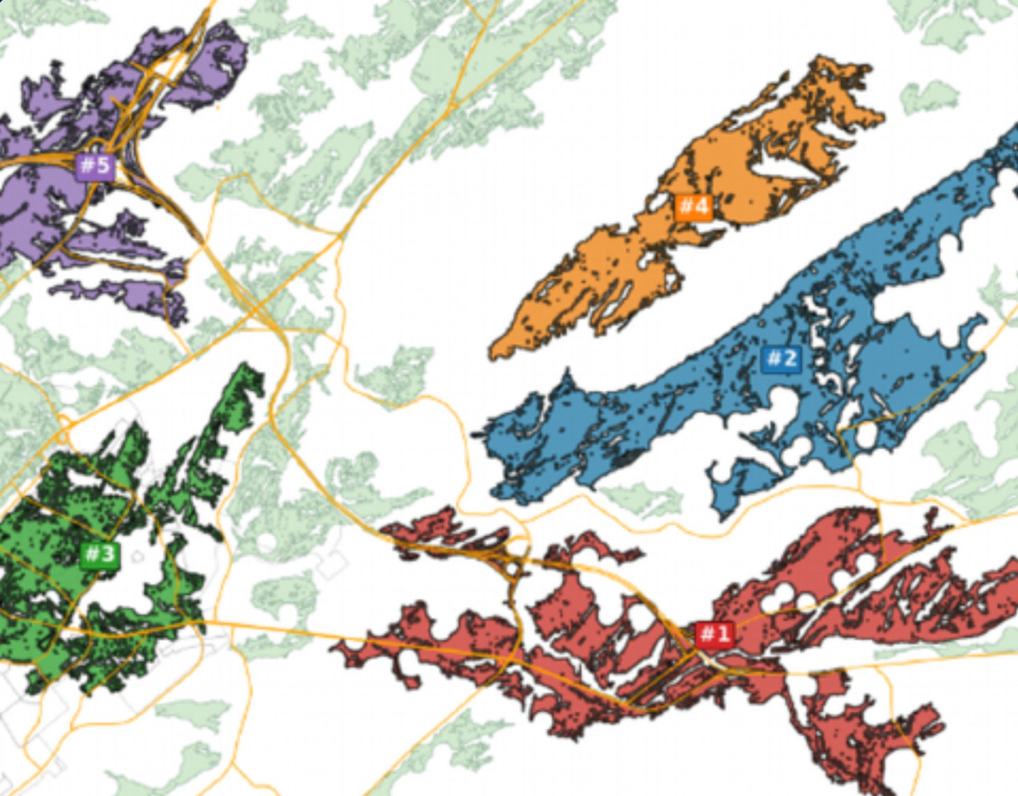
Screen the College Township and State College area for utility-scale solar sites. Keep nearly flat or gently sloped (10° or less), roughly south-facing land; exclude flood zones, wetlands, and land within 100 m of karst features. Rank remaining connected sites of at least 10 ha by area and distance to state roads, and summarize the top five, including zoning.
Approach
Mapped terrain
Slope and aspect from USGS elevation data.
Kept suitable land
Flat or gently sloped, roughly south-facing areas.
Removed constraints
Flood zones, wetlands, and land within 100 m of karst features.
Defined sites
Connected areas of 10 ha (25 acres) or more.
Ranked and reported
Area, road access, and zoning for the leading candidates.
Results
35 sq mi
Area screened
90.1 km²
32
Candidate sites
Each at least 25 acres, totaling approximately 6,900 acres
1,267 acres
Largest candidate site
512.85 ha, nearly flat and approximately 40 ft from a state road
Business value
Prioritize investment
Focus detailed engineering and feasibility studies on a smaller shortlist.
Reduce early-stage uncertainty
Identify environmental and geological constraints earlier.
Support planning efficiency
Combine public datasets into one preliminary assessment.
This screening does not establish final buildability, permitting eligibility, or site approval.
How we verified the results
- Checked
Total suitable area
Total suitable area was measured two ways; differences reflected small fragments excluded by the 25-acre threshold.
- Checked
Largest site
The largest site area was independently recalculated and road distance remeasured at about 12 m (40 ft).
- Recorded
Human confirmations
Three human confirmations were logged; further expert review is recommended.