The challenge
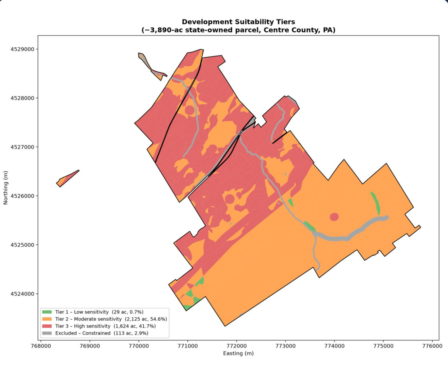
A client evaluating a roughly 3,900-acre state-owned property needed an early understanding of development constraints and groundwater recharge. Limestone geology creates localized sinkhole risk and recharge pathways, making it important to assess where development may require further study and how future conditions could affect planning.
The question
For this roughly 3,900-acre property, where are mapped development constraints and areas of higher geological sensitivity? Is groundwater recharge spatially concentrated, and how might estimates change under future scenarios?
Approach
Mapped constraints
Wetlands, 100-year floodplains, 150-ft stream buffers, and state game lands.
Classified karst sensitivity
Low, moderate, or high.
Estimated recharge
The amount and spatial distribution of recharge.
Modeled future recharge
Under three climate scenarios to approximately 2050.
Compared with USGS
Recharge estimates compared with published USGS figures.
Results
97.1%
Free of the mapped constraints considered
About 3,778 of 3,890 acres
41.7%
High sinkhole risk
1,624 acres, warranting geotechnical investigation
2.85M gal
Estimated daily groundwater recharge
Approximately 9.9 inches annually
Being free of mapped constraints does not establish development suitability.
Business value
Guide land-use decisions
Identify areas meriting additional feasibility and geotechnical investigation.
Protect water resources
Incorporate groundwater recharge and geological sensitivity into planning.
Support long-term investment
Compare development options against potential future environmental conditions.
This is preliminary screening, not a determination of engineering feasibility or regulatory approval.
How we verified the results
- Checked
Recharge estimate
The recharge estimate was compared with published USGS estimates for the Spring Creek basin.
- Checked
Mapped constraints
Individual mapped constraint areas were also checked against their combined, overlap-adjusted total.
- Still required
Expert review
Expert review and site-specific studies remain necessary.